Lee’s Ferry – Glen Canyon National Recreation Area (Arizona)

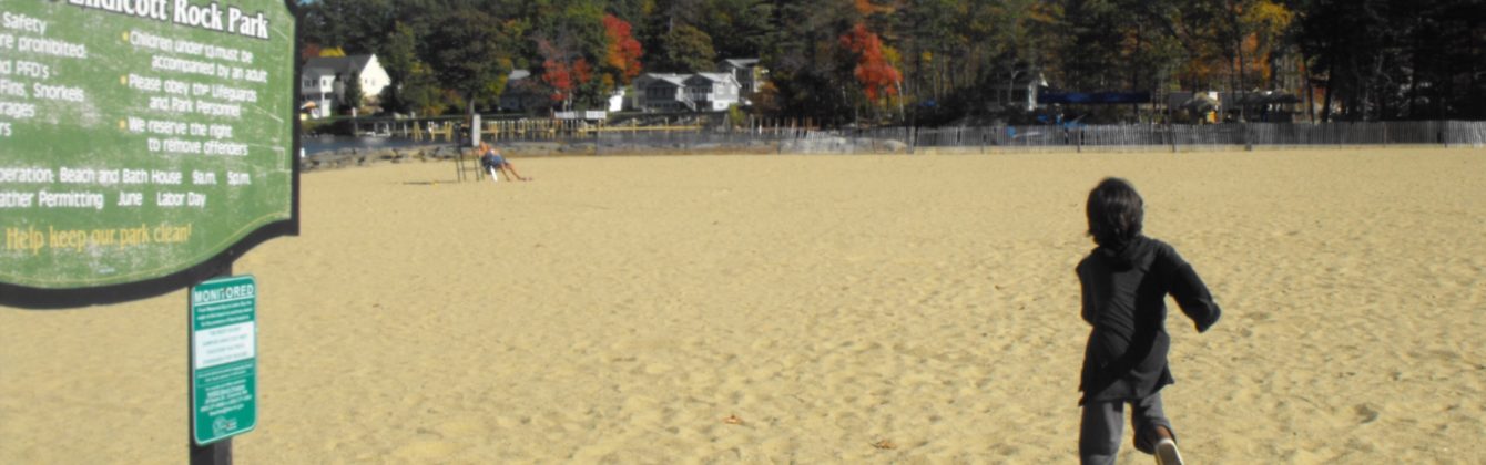
Lee’s Ferry is a common launching point for river runners starting their journey through Marble Canyon and then onward to the Grand Canyon. It is part of the Glen Canyon National Recreation Area. Marble Canyon is also well known for the Navajo Bridge, where US Highway 89A crosses the Colorado River. This is one of the very few areas where you can reach the Colorado River by car. Due to its unique geography – the only place in hundreds of miles from which one can easily access the Colorado River from both sides – it historically served as an important river crossing and starting in the mid-19th century was the site of a ferry operated by John Doyle Lee, for whom it is named. Boat service at Lees Ferry continued for over 60 years before being superseded by a bridge in the early 20th century, which allowed for much more efficient automobile travel.

New photo by Wanderlust Family Adventure / Google Photos

Grand Canyon North Rim – North Rim, Arizona

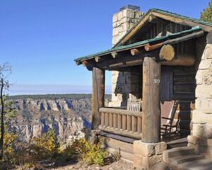
The north rim of the Grand Canyon is the much less visited portion of the national park. The area includes a Visitor Center, the Grand Canyon Lodge, and a number of hiking trails, including the Bright Angel Point Trail and Transept Trail. The views are not quite as expansive as on the south rim but the lack of crowds is a nice change of pace.

New photo by Wanderlust Family Adventure / Google Photos

Zion National Park – Springdale, Utah

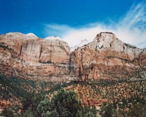
Zion National Park is located in southwestern Utah near the town of Springdale. A prominent feature of the 229-square-mile park is Zion Canyon, which is 15 miles long and up to 2,640 feet deep. The canyon walls are reddish and tan-colored Navajo Sandstone eroded by the North Fork of the Virgin River. The lowest point in the park is 3,666 feet at Coalpits Wash and the highest peak is 8,726 ft at Horse Ranch Mountain. Located at the junction of the Colorado Plateau, Great Basin, and Mojave Desert regions, the park has a unique geography and a variety of life zones that allow for unusual plant and animal diversity. Numerous plant species as well as 289 species of birds, 75 mammals (including 19 species of bat), and 32 reptiles inhabit the park’s four life zones: desert, riparian, woodland, and coniferous forest. Zion National Park includes mountains, canyons, buttes, mesas, monoliths, rivers, slot canyons, and natural arches. Zion is my favorite western national park with its spectacular vistas. unique hiking trails and stunning topography.

New photo by Wanderlust Family Adventure / Google Photos

One of the unique hikes is up through the Virgin River in the Narrows. As you wade through the river bed shear cliffs surround you on either side.

New photo by Wanderlust Family Adventure / Google Photos

Bryce Canyon National Park – Bryce, Utah

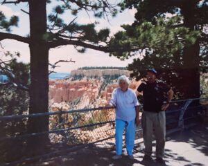
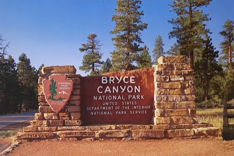
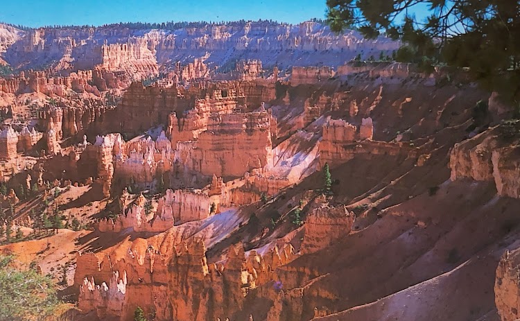
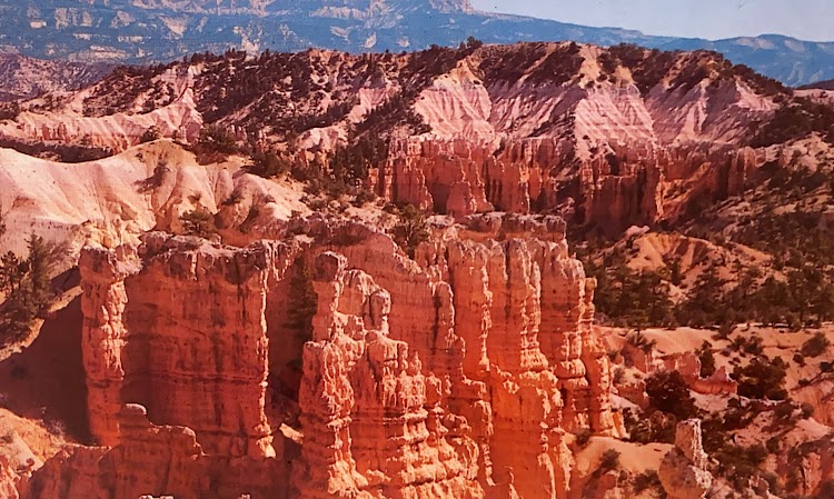
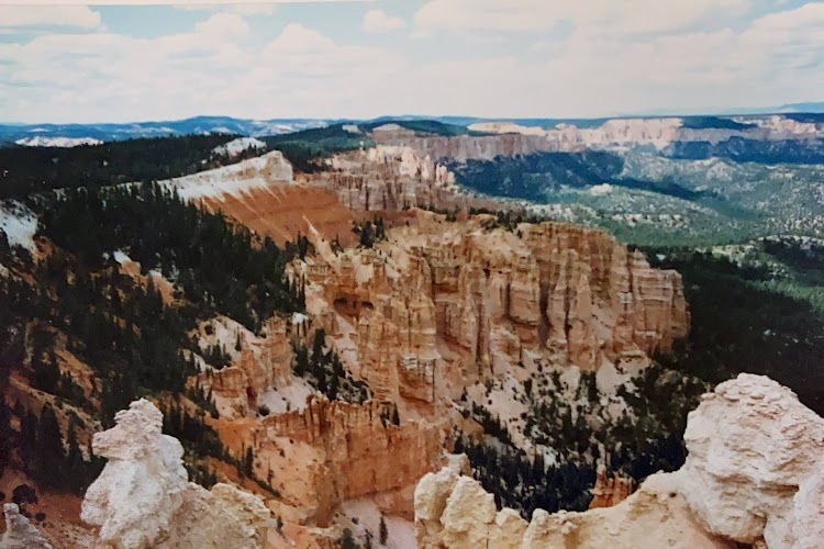
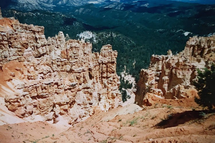
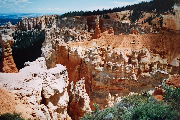
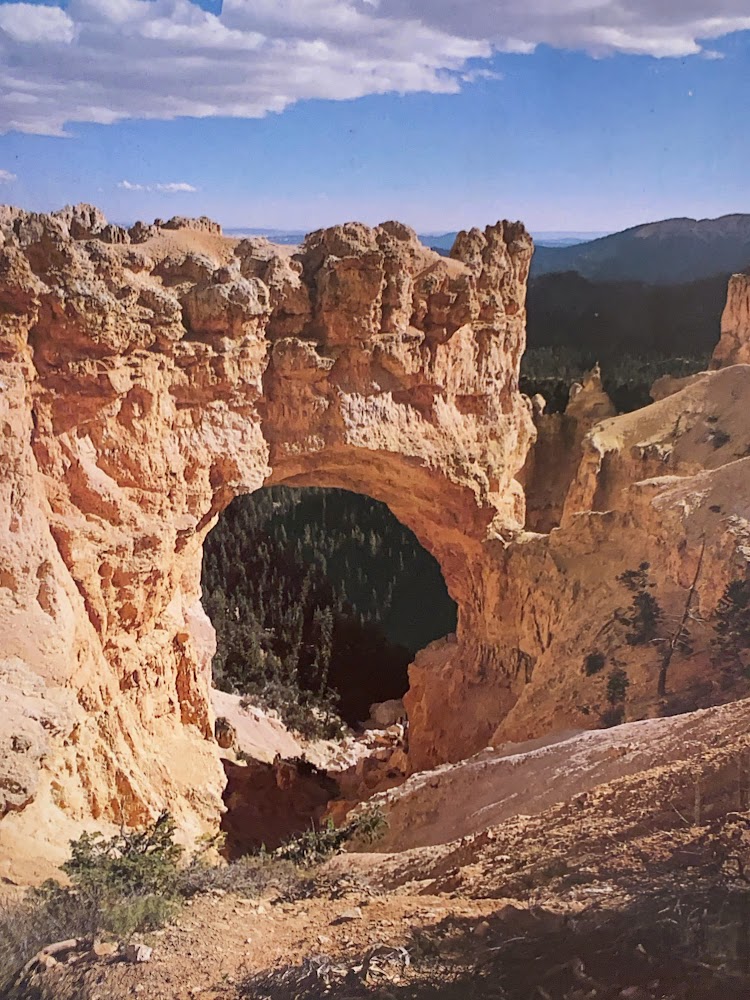
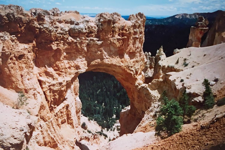
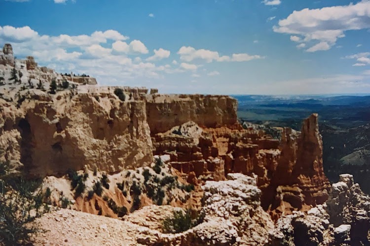
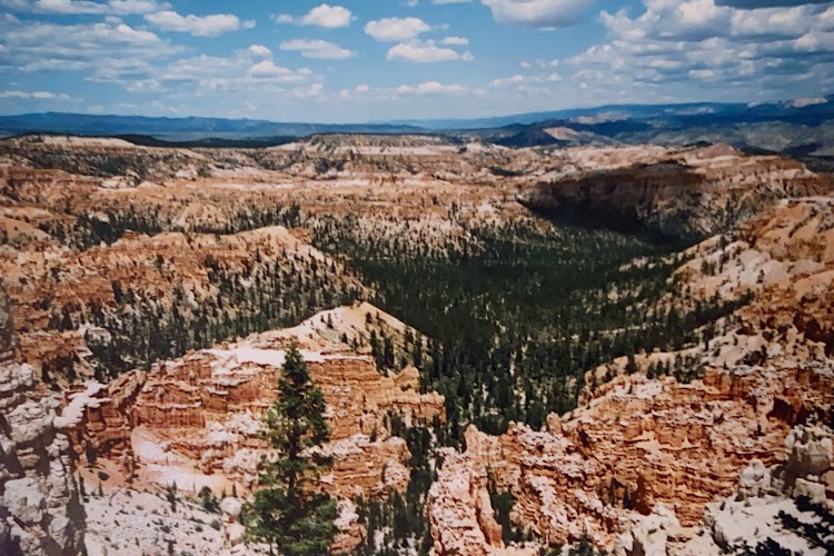
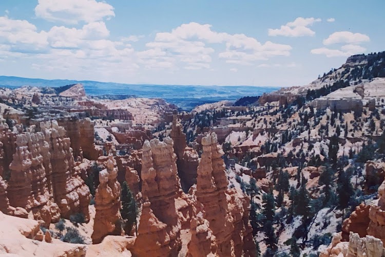
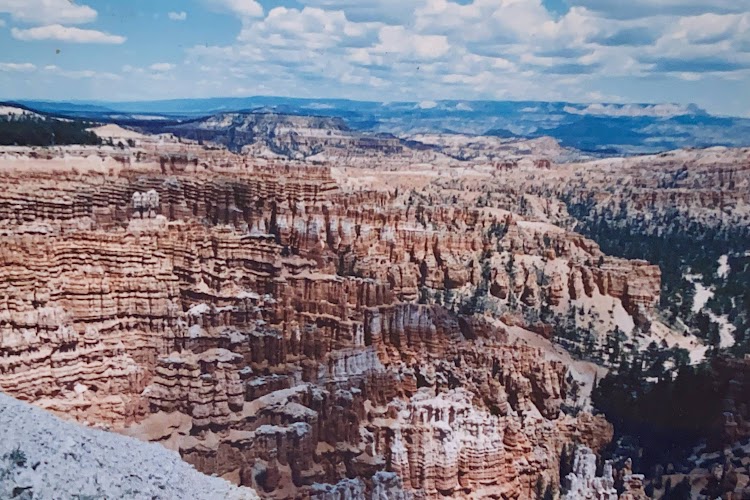
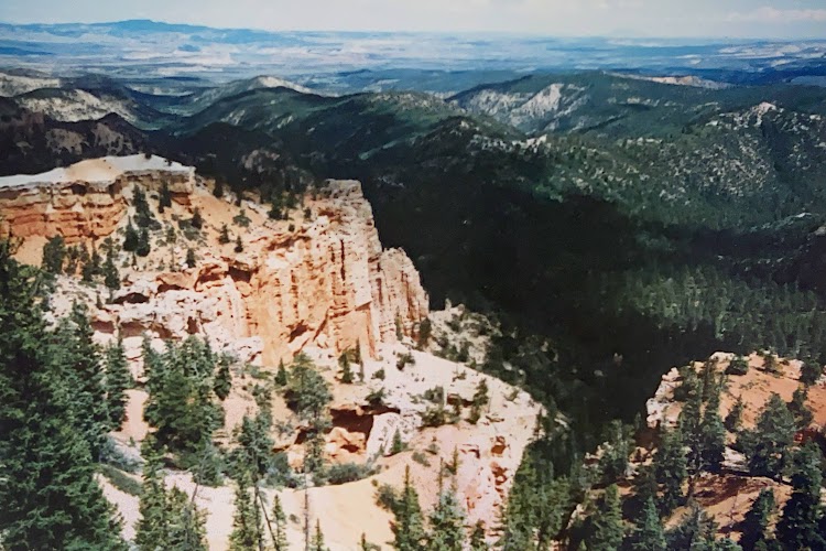
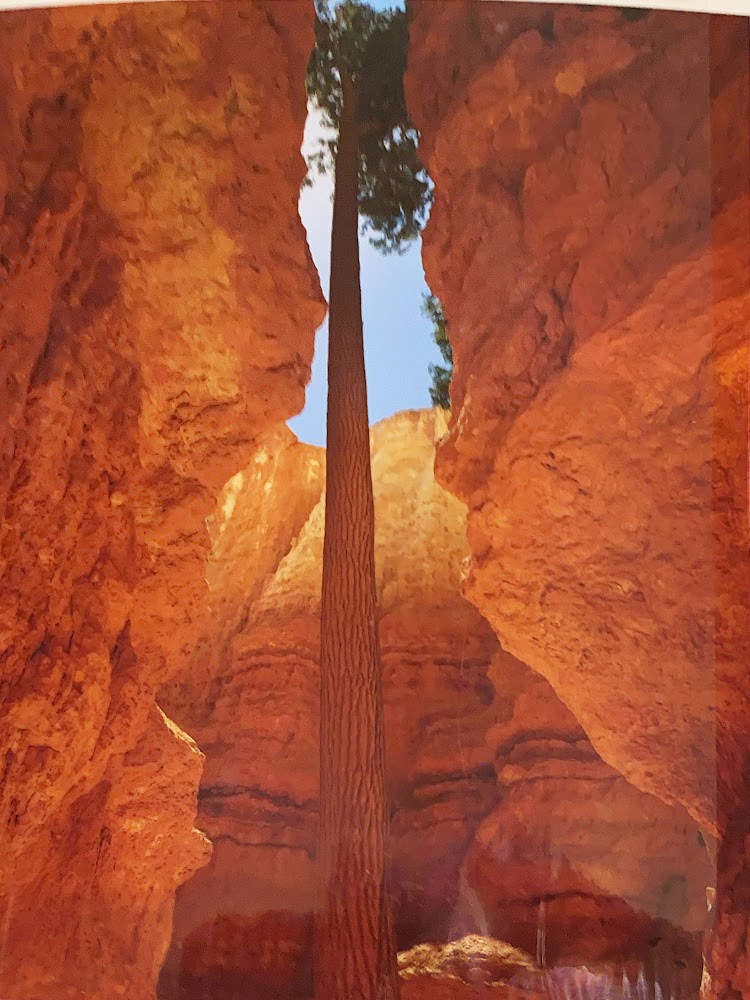
Bryce Canyon National Park is located in southwestern Utah. The major feature of the park is Bryce Canyon, which despite its name, is not a canyon, but a collection of giant natural amphitheaters along the eastern side of the Paunsaugunt Plateau. Bryce is distinctive due to geological structures called hoodoos, formed by frost weathering and stream erosion of the river and lake bed sedimentary rocks. The red, orange, and white colors of the rocks provide spectacular views for park visitors. The rim at Bryce varies from 8,000 to 9,000 feet. The Bryce Canyon area was settled by Mormon pioneers in the 1850s and was named after Ebenezer Bryce, who homesteaded in the area in 1874.

New photo by Wanderlust Family Adventure / Google Photos

Most of the formations can be easily seen from the cliffside on the park road.

New photo by Wanderlust Family Adventure / Google Photos

There are trails that lead down into the eroded amphitheater. It is definitely a different view looking up towards the cliff rim.

New photo by Wanderlust Family Adventure / Google Photos

The campground has some very habituated wildlife.

New photo by Wanderlust Family Adventure / Google Photos

Capitol Reef National Park – Torrey, Utah

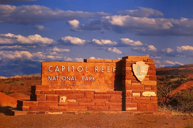
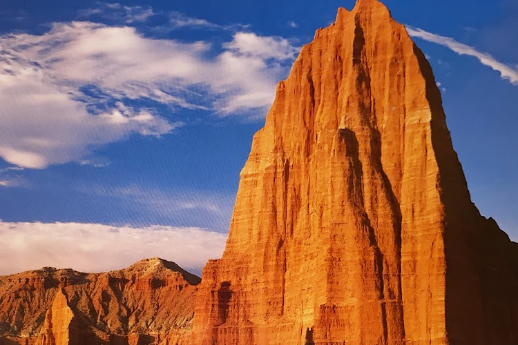
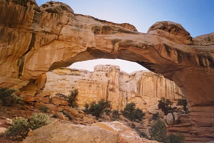
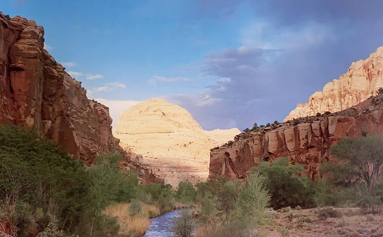
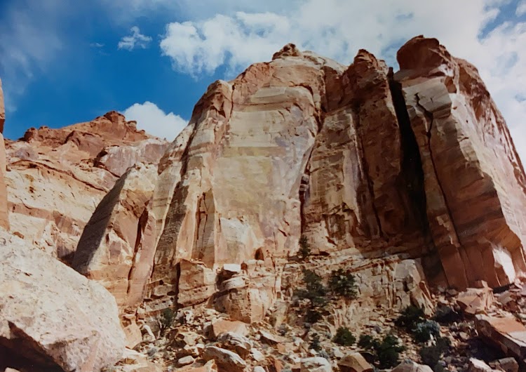
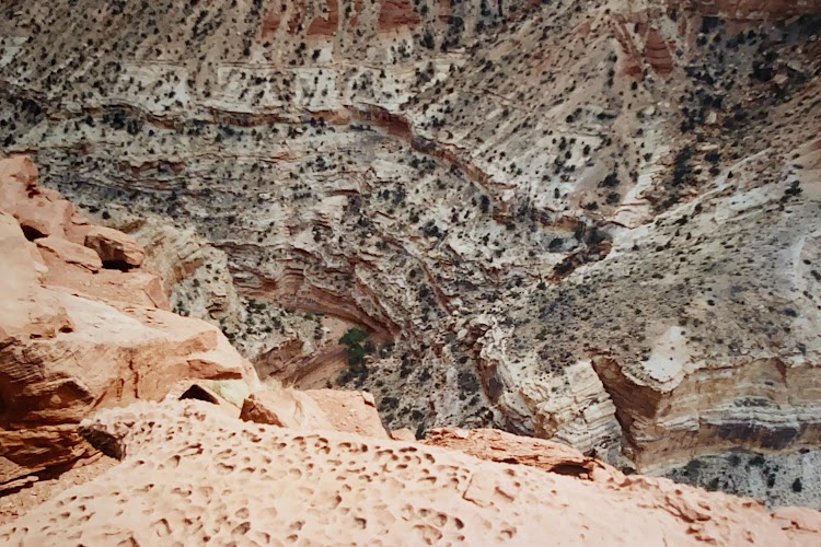
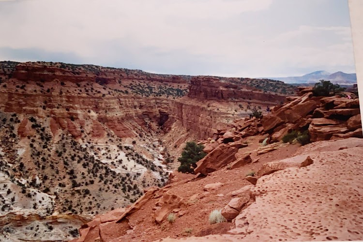
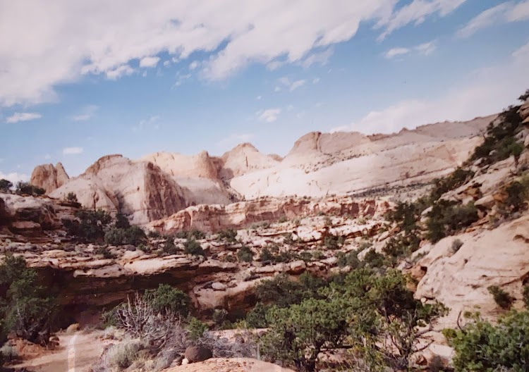
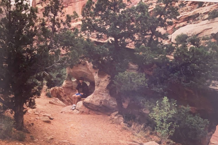
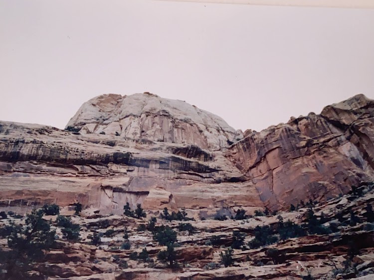
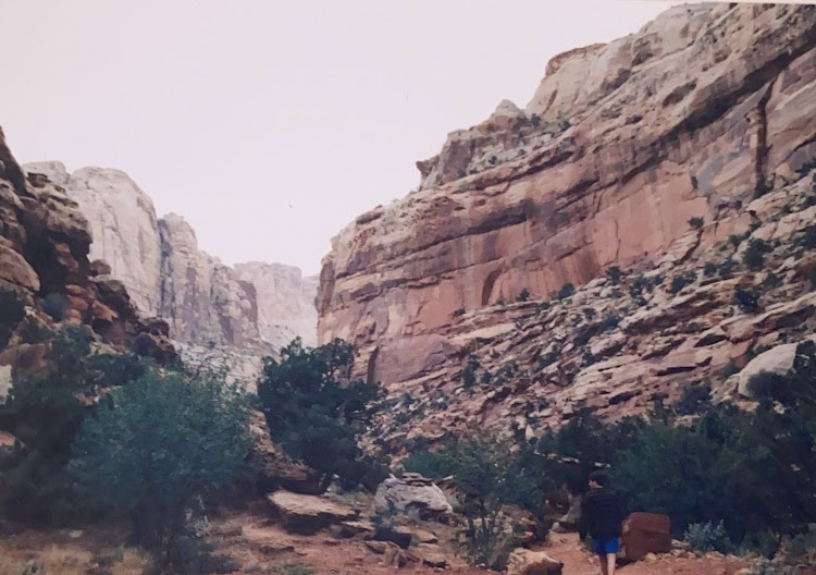
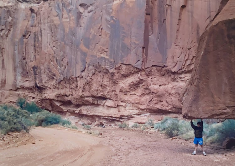
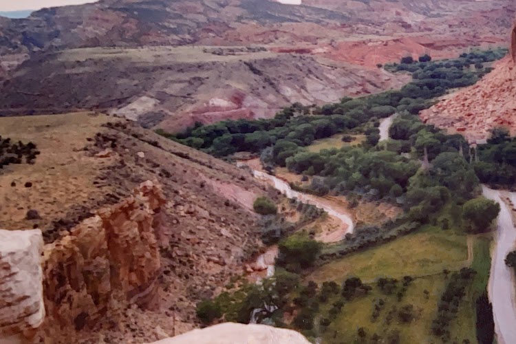
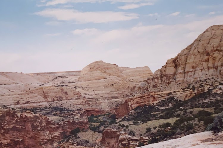
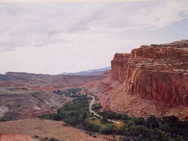
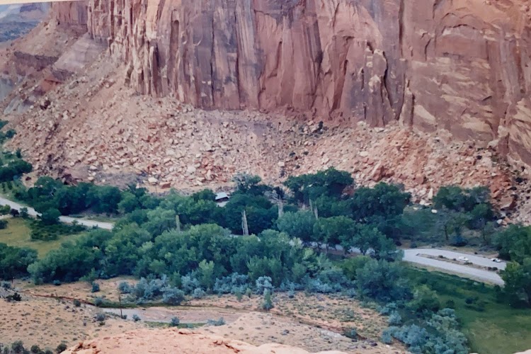
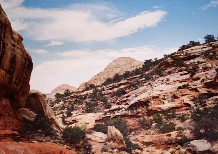
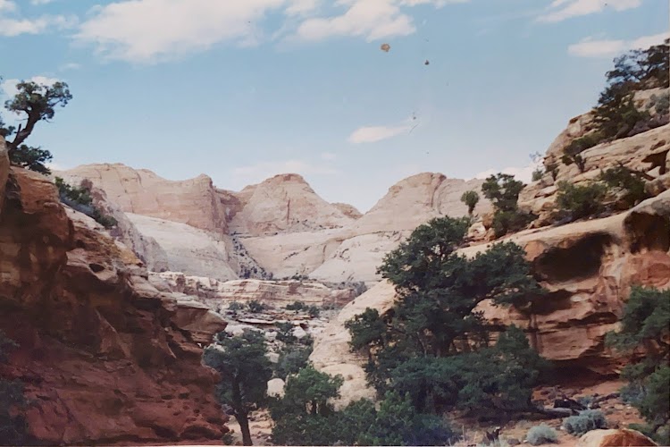
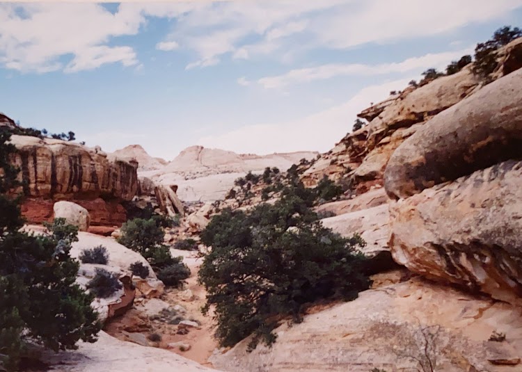
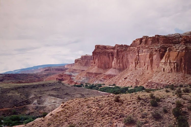
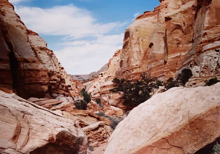
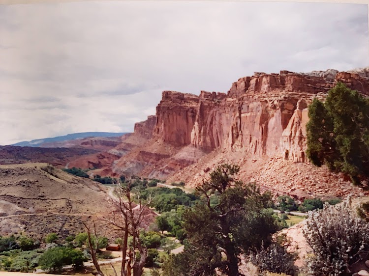
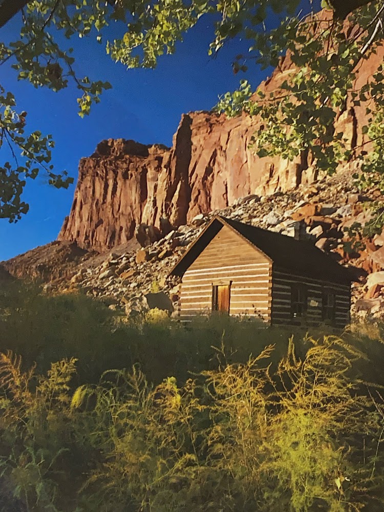
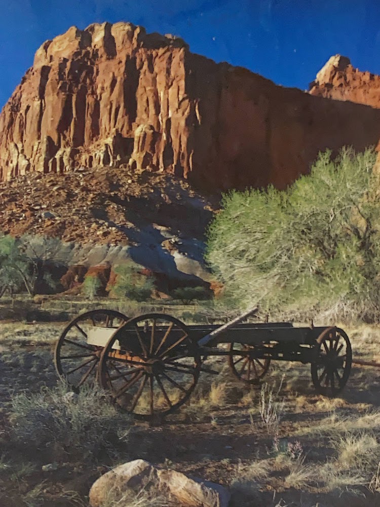
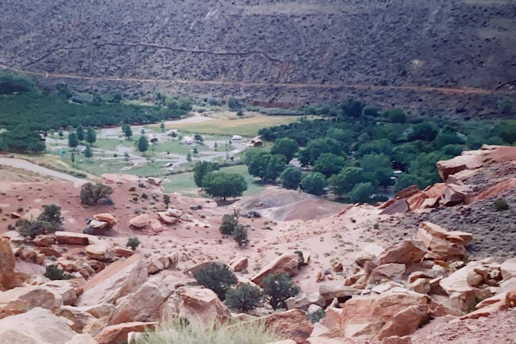
Capitol Reef National Park is in south-central Utah near the town or Torrey. The park is approximately 60 miles long on its north–south axis and just 6 miles wide on average. The majority of the nearly 100 mi long up-thrust formation called the Waterpocket Fold, a rocky spine extending from Thousand Lake Mountain to Lake Powell, is preserved within the park. Capitol Reef is an especially rugged and spectacular segment of the Waterpocket Fold by the Fremont River. The park was named for its whitish Navajo Sandstone cliffs with dome formations, similar to the white domes often placed on capitol buildings, that run from the Fremont River to Pleasant Creek on the Waterpocket Fold.

New photo by Wanderlust Family Adventure / Google Photos

There are many remnants of the pioneer settlers of the area, mostly Mormon.

New photo by Wanderlust Family Adventure / Google Photos

The park also has some petroglyphs to see.

New photo by Wanderlust Family Adventure / Google Photos

The campground is nestled in an apricot orchard and the local mule deer usually make a visit.

New photo by Wanderlust Family Adventure / Google Photos