Valley Forge National Historical Park – King of Prussia, Pennsylvania

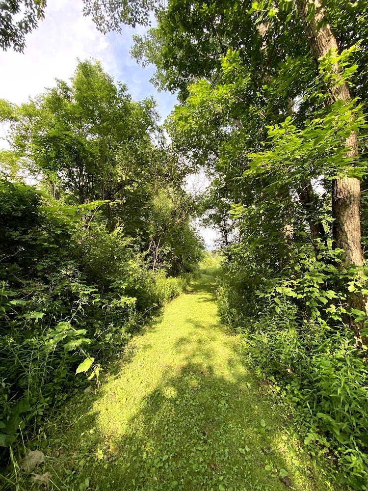
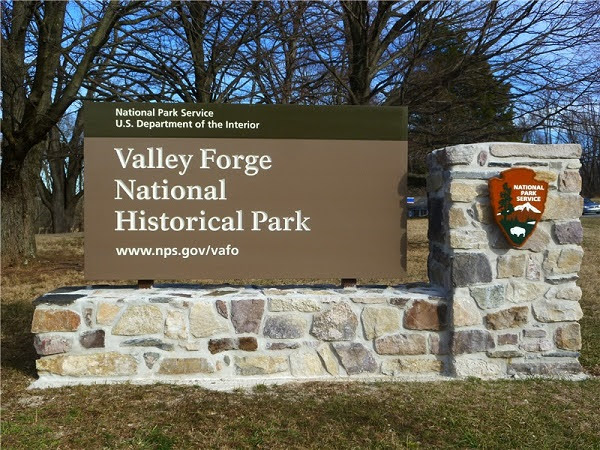
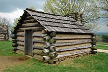
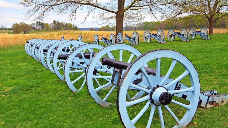
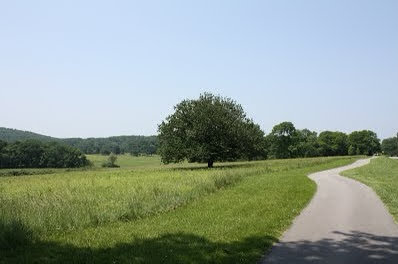
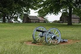
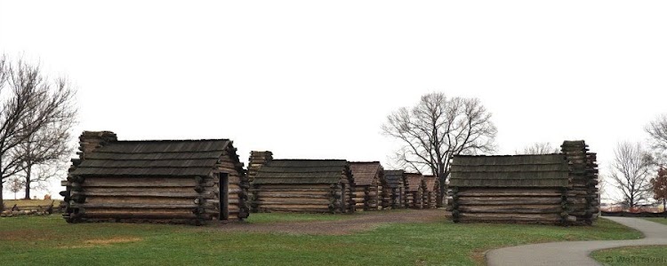
Valley Forge National Historical Park is the site of the third winter encampment of the Continental Army during the American Revolutionary War, taking place from December 19, 1777 to June 19, 1778. The National Park Service preserves the site and interprets the history of the Valley Forge encampment. Originally Valley Forge State Park, it became a national historical park in 1976. The park contains historical buildings, recreated encampment structures, memorials, museums, and recreation facilities. The park encompasses 3,500 acres. Visitors can see restored historic structures, reconstructed structures such as the iconic log huts, and monuments erected by the states from which the Continental soldiers came. Visitor facilities include a visitor center and museum featuring original artifacts, providing a concise introduction to the American Revolution and the Valley Forge encampment. Ranger programs, tours, and activities are available seasonally. The park also provides 26 miles of hiking and biking trails, which are connected to a robust regional trails system. Wildlife watching, fishing, and boating on the nearby Schuylkill River also are popular.

New photo by Wanderlust Family Adventure / Google Photos

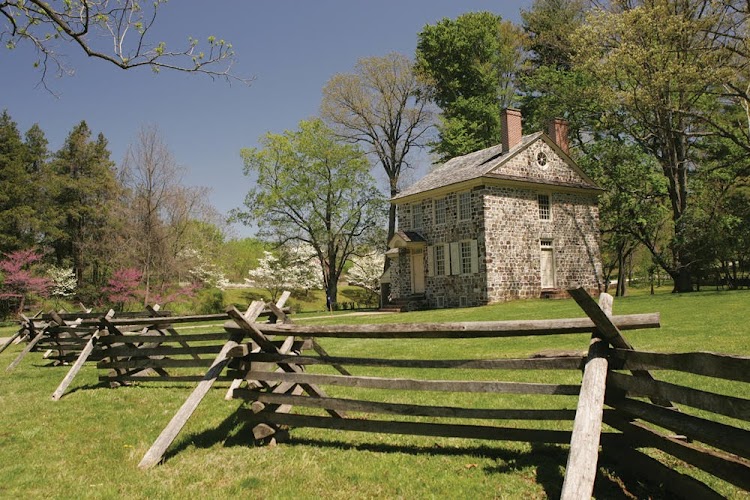
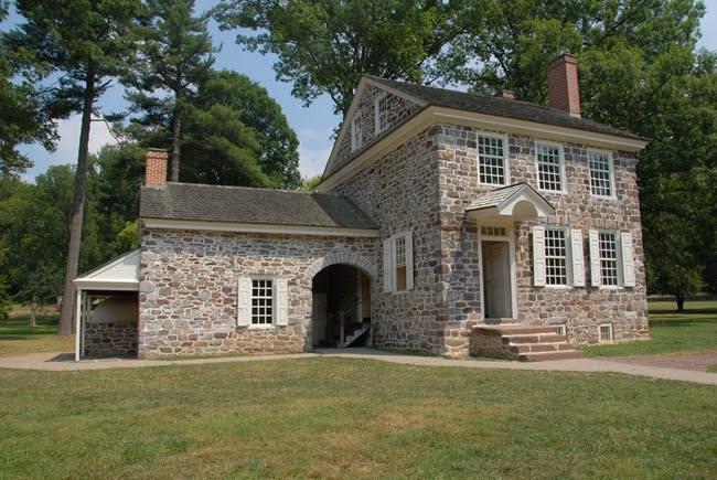
A key attraction of the park is the restored colonial home used by General George Washington as his headquarters during the encampment.

New photo by Wanderlust Family Adventure / Google Photos

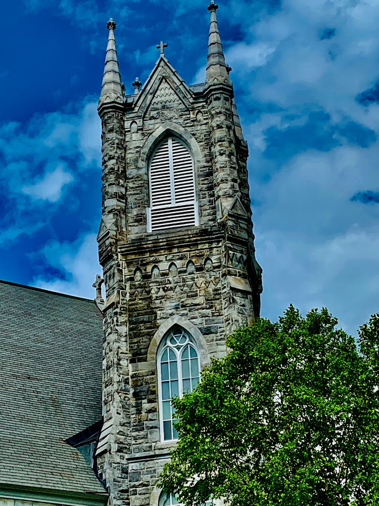
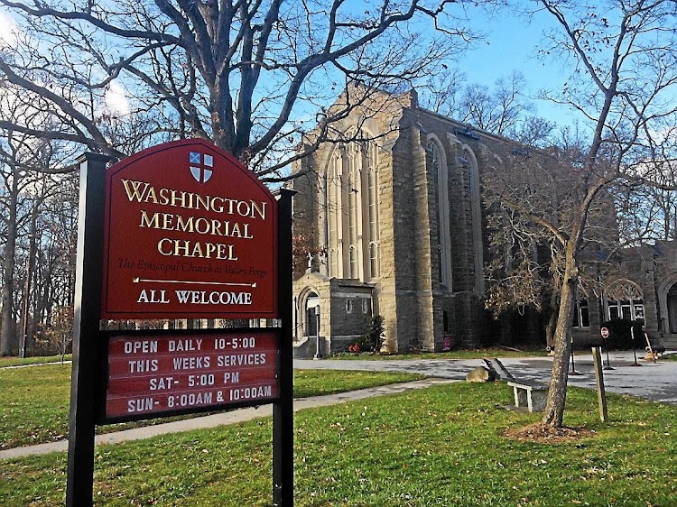
The Washington Memorial Chapel and National Patriots Bell Tower carillon sit atop a hill at the center of the present park.

New photo by Wanderlust Family Adventure / Google Photos

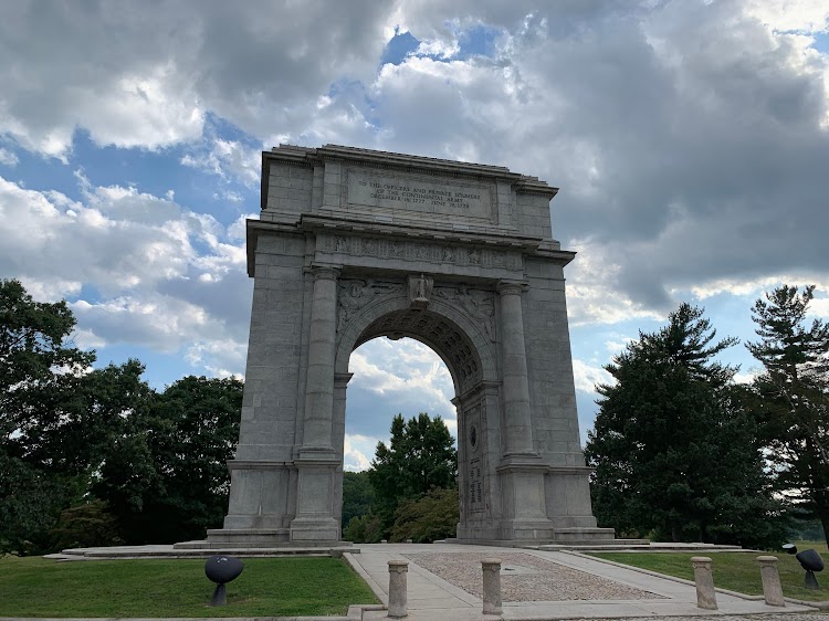
Sitting atop a hill at the intersection of the Outer Line of Defense with the Gulph Road, the National Memorial Arch dominates the southern portion of the park. It is dedicated “to the officers and private soldiers of the Continental Army December 19, 1777 – June 19, 1778.”

New photo by Wanderlust Family Adventure / Google Photos

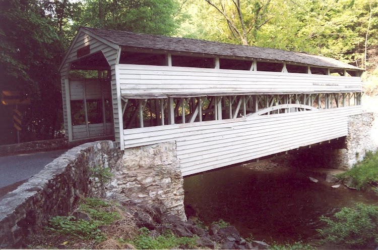
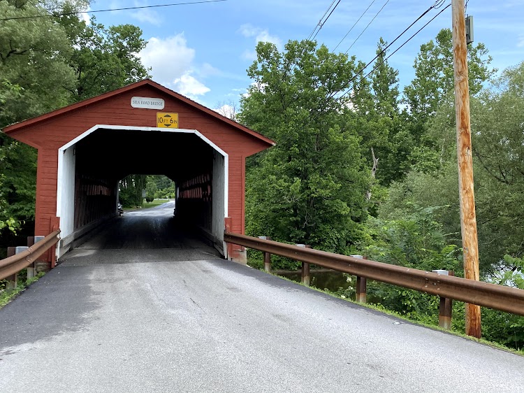
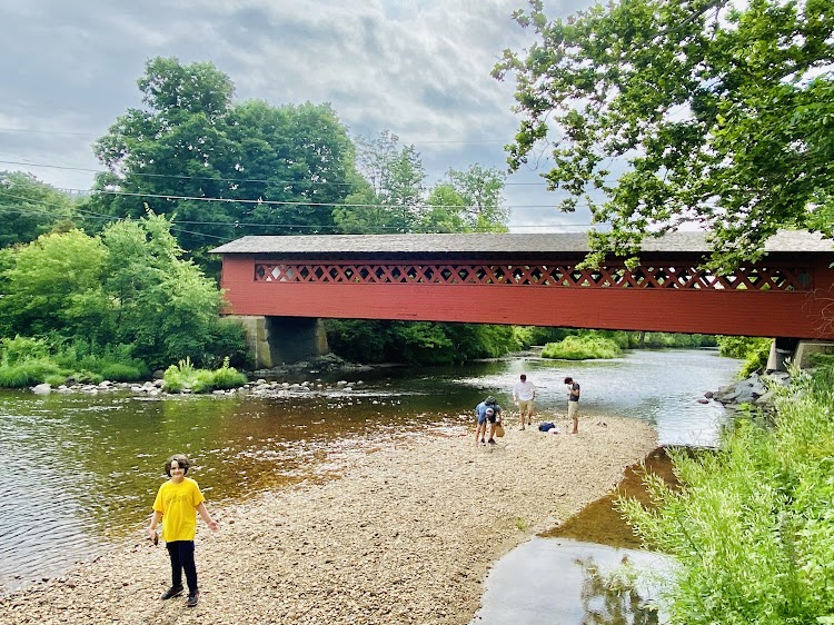
The Knox Covered Bridge is on site.

New photo by Wanderlust Family Adventure / Google Photos

Knox Covered Bridge – Valley Forge National Historical Park (King of Prussia, Pennsylvania)

This mid-19th century Knox Covered Bridge was constructed by Robert Russell using a Burr Arch Truss and wooden planks, which are still in good shape today. Recently, it went under a rehabilitation by the National Park Service. The bridge is located in Valley Forge National Historical Park in Pennsylvania. It was named after either Philander C. Knox (1855-1921) United States Senator from Pennsylvania who owned 256 acres of land near the bridge or General Henry Knox (1750-1806) an officer quartered at Valley Forge during the winter of 1777-1778.

New photo by Wanderlust Family Adventure / Google Photos

Allen Hollis Covered Bridge – Kinsman Notch, New Hampshire

The Lost River Gorge and Boulder Caves is a series of glacial caves, waterfalls and cascades in Kinsman Notch, New Hampshire. A recent addition to the walkways winding its way through the gorge is a pedestrian covered bridge The Allen Hollis Bridge.

New photo by Wanderlust Family Adventure / Google Photos

Lost River Gorge and Boulder Caves – Kinsman Notch, New Hampshire

The Lost River Gorge & Boulder Caves, located in New Hampshire’s Kinsman Notch in the White Mountains, is a series of boulder caves surrounded by flowing water. The Ice Age brought glaciers more than a mile thick to this area that grounded, lifted, and deposited rocks that formed notches and mountains. When the ice melted, the water carried debris, eroding the rocks and forming Lost River Gorge. Lost River is so-named because the brook draining from the south east part of Kinsman Notch disappears below the surface in the narrow, steep-walled glacial gorge. The Gorge is partially filled with immense blocks of granite, through which the brook cascades along its subterranean course until it eventually emerges and joins the Pemigewasset River. The first documented exploration of Lost River took place in 1852. When the Jackman brothers, Royal and Lyman, were fishing along the stream the boys worked their way over and around the boulders when suddenly Lyman disappeared out of sight. Lyman had slipped into a moss covered hole and fallen into a cave about 15 feet below into a pool of water about waist deep. Now known as Shadow Cave, it was the first of the many caves the boys would soon discover.

New photo by Wanderlust Family Adventure / Google Photos

Molly Stark Scenic Byway – Southern Vermont

The Molly Stark Scenic Byway follows VT Route 9 from Bennington to Brattleboro. The drive is spectacular during the fall foliage season but is a destination to be sought out during any season. During the summer months there are State Parks with hiking, swimming and boating opportunities. Starting in Bennington there are a number of sites within town before you head out. The Bennington Battle Monument commemorates the Revolutionary War Battle of Bennington.

New photo by Wanderlust Family Adventure / Google Photos

As you make your way through town look for the beautiful Catholic Church in the town center.

New photo by Wanderlust Family Adventure / Google Photos

There are three covered bridges in Bennington; The Silk Road Bridge,

New photo by Wanderlust Family Adventure / Google Photos

The Paper Mill Village Bridge,

New photo by Wanderlust Family Adventure / Google Photos

and the Burt Henry Covered Bridge

New photo by Wanderlust Family Adventure / Google Photos

which is in the McWater Park.

New photo by Wanderlust Family Adventure / Google Photos

Stop off for some quiet contemplation at the Hinsdillville Green.

New photo by Wanderlust Family Adventure / Google Photos

If you want to stretch your legs take a nice walk through some woods and meadows at the Norman and Selma Greenberg Conservation Reserve.

New photo by Wanderlust Family Adventure / Google Photos

Heading out of Town on the Molly Stark Highway

New photo by Wanderlust Family Adventure / Google Photos

stop for a swim at the Woodford State Park

New photo by Wanderlust Family Adventure / Google Photos

Further along you can have a picnic or hike at the Molly Stark State Park.

New photo by Wanderlust Family Adventure / Google Photos

There are some steep sections of roads as you descend the Green Mountains look out for the runaway truck ramps on the side of the road.

New video by Wanderlust Family Adventure / Google Photos

The charming town of Wilmington

New photo by Wanderlust Family Adventure / Google Photos

has a statue of Molly Stark in the town center.

New photo by Wanderlust Family Adventure / Google Photos

There are great views along the entire route.

New photo by Wanderlust Family Adventure / Google Photos

The Hogback Mountain Overlook gives you the most spectacular view along the trail.

New photo by Wanderlust Family Adventure / Google Photos

Just past the overlook take in the Southern Vermont Natural History Museum.

New photo by Wanderlust Family Adventure / Google Photos

The end of the trail brings you to Brattleboro. The Creamery Covered Bridge

New photo by Wanderlust Family Adventure / Google Photos

is located in the Living Memorial Park.

New photo by Wanderlust Family Adventure / Google Photos

A beautiful scenic drive comes to an end.