Custer State Park – Custer, South Dakota

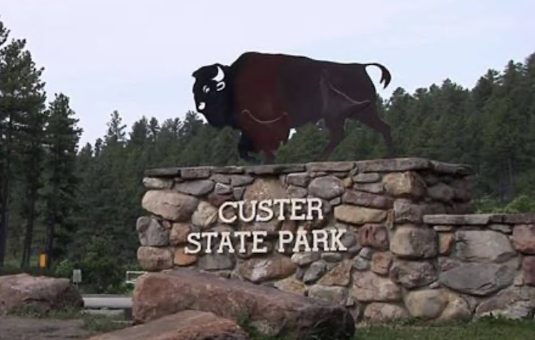
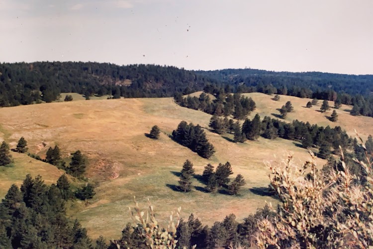
Custer State Park is a State Park and wildlife reserve in Custer, South Dakota. The park is South Dakota’s largest and first state park, named after Lt. Colonel George Armstrong Custer.

New photo by Wanderlust Family Adventure / Google Photos

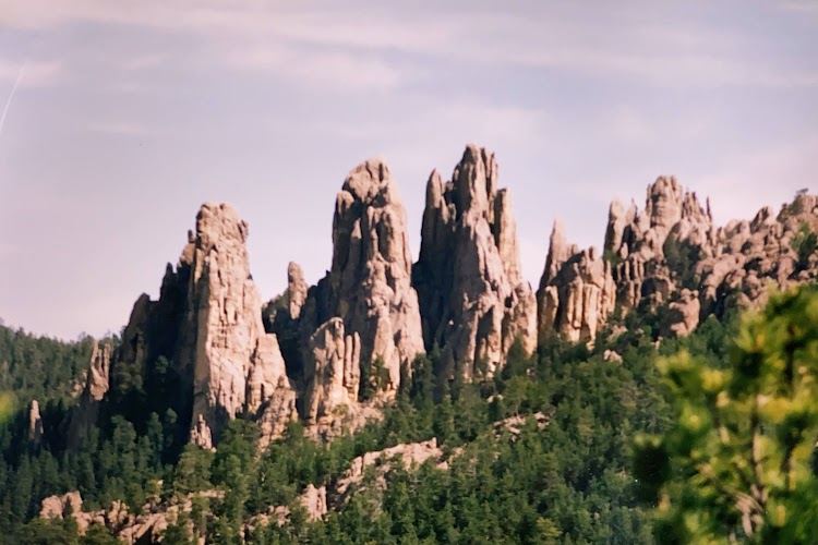
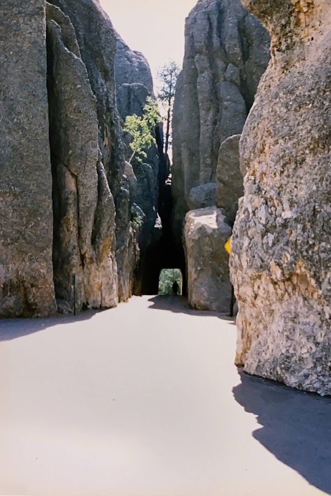
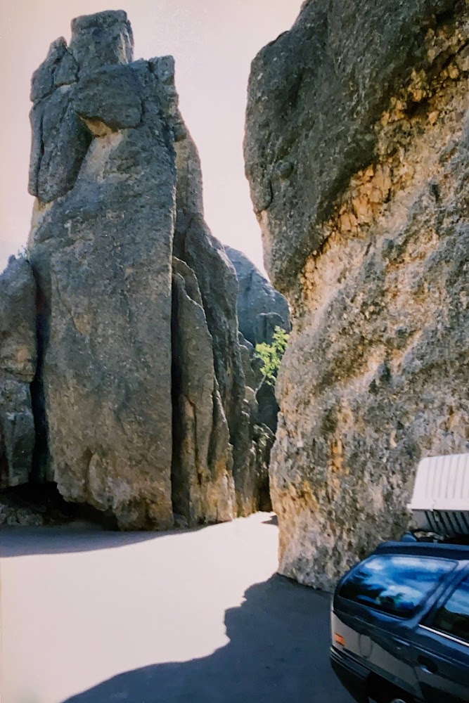
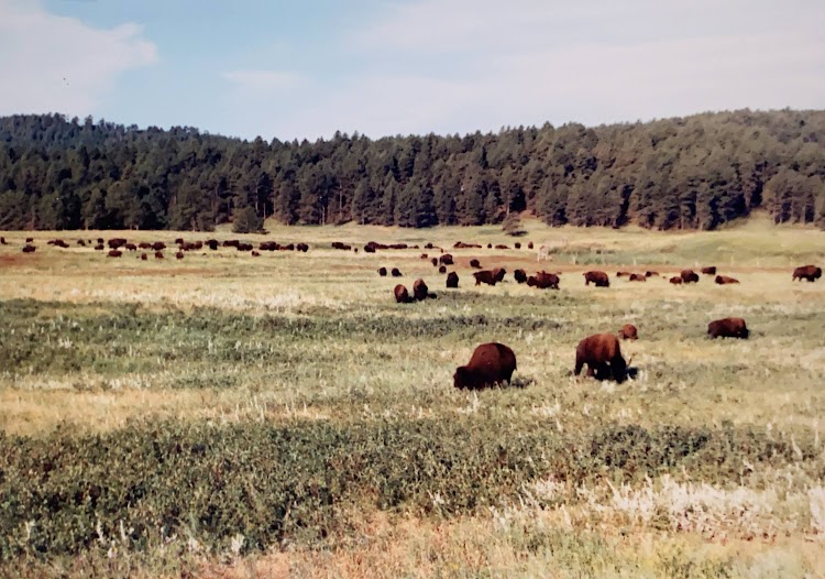
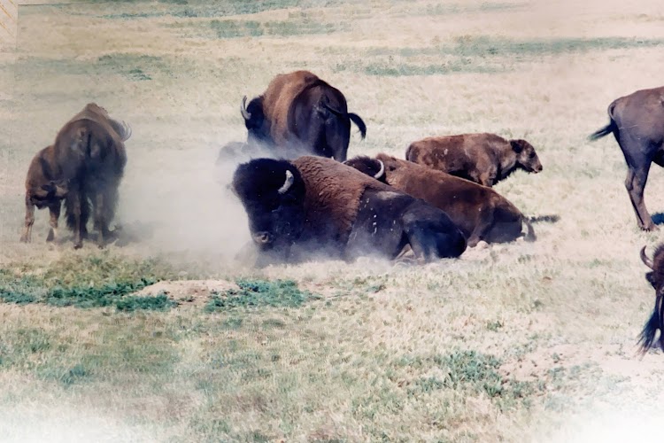
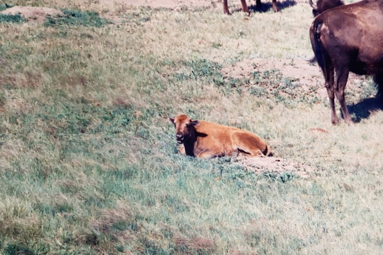
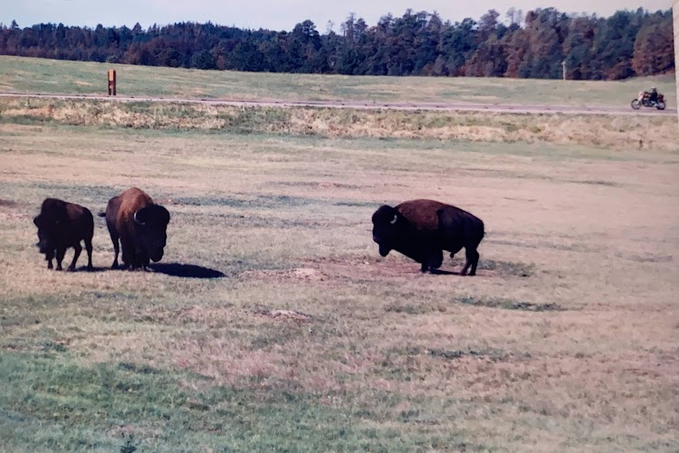
The park covers an area of over 71,000 acres of hilly terrain and is home to many wild animals, the park is home to a famous herd of 1500 free roaming bison. Elk, coyotes, mule deer, white tailed deer, mountain goats, prairie dogs, bighorn sheep, river otters, pronghorn, cougars, and feral burros also inhabit the park. The park is famous for its scenery, its scenic drives (Needles Highway and the wildlife loop), with views of the bison herd and prairie dog towns. Along with the adjacent Wind Cave National Park this area is a superb example of a preserved prairie ecosystem. The needles highway in the park offers wonderful views through the rock pinnacles. Beware some of the tunnels are extremely narrow and do not offer much clearance.

New photo by Wanderlust Family Adventure / Google Photos

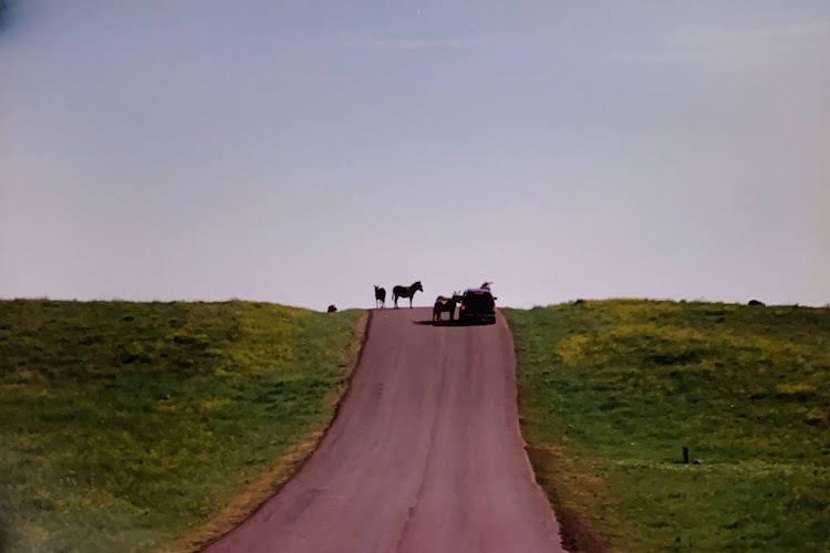
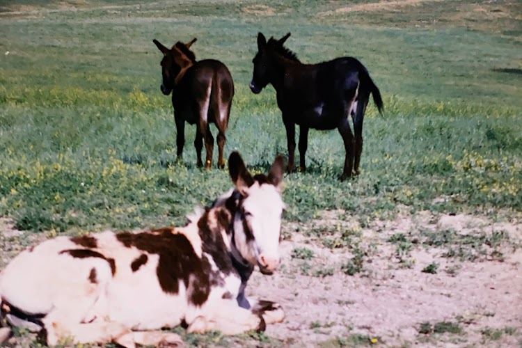
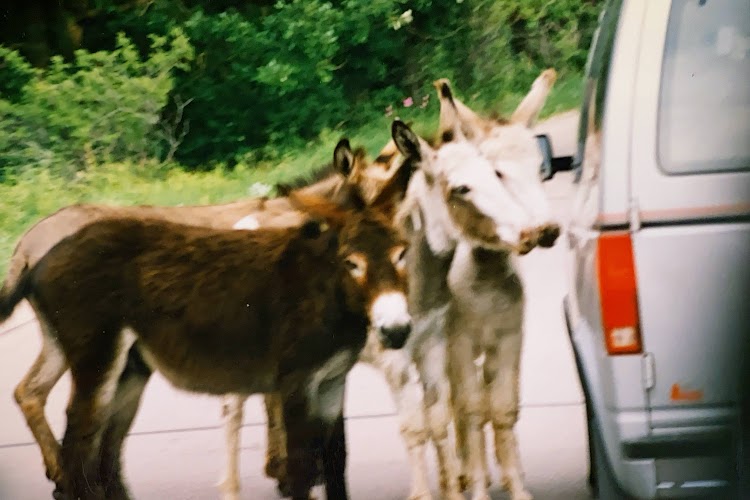
Wildlife is a top attraction, the best time for a game drive is either at dawn or dusk. Feral donkeys are very friendly and will come right up to your car windows.

New photo by Wanderlust Family Adventure / Google Photos

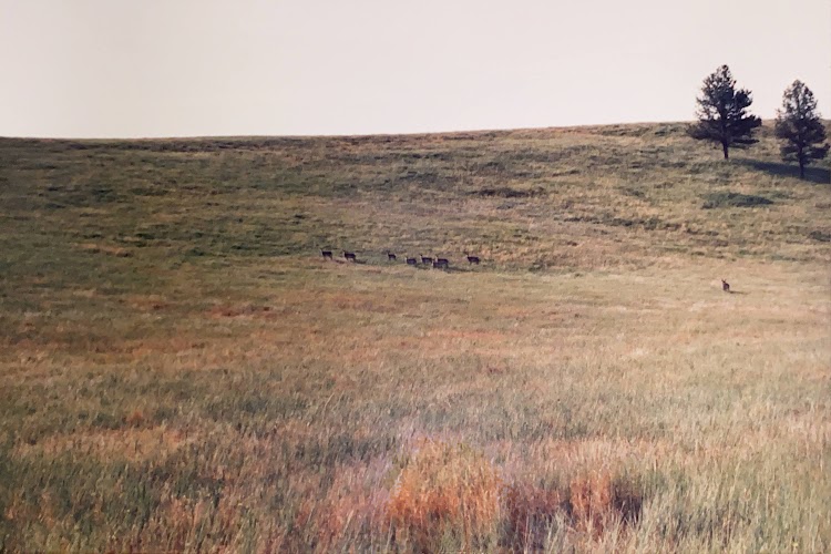
The pronghorns are easily seen but hard to get close to. My nephew Roger and I tried to track them through the hills but this is as close as we got. Notice how there is a lookout and as soon as you get too close they head for the hills. If you want good pictures bring a telephoto lens.

New photo by Wanderlust Family Adventure / Google Photos

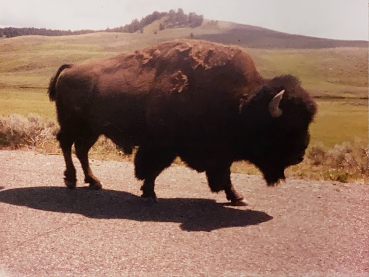
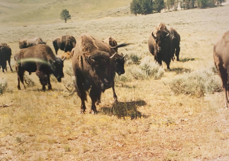
The bison are easily seen and gregarious. Do not get too close they are not cows and they trample many tourists who do not pay them due respect.

New photo by Wanderlust Family Adventure / Google Photos

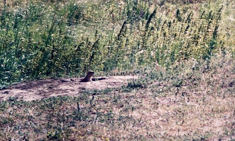
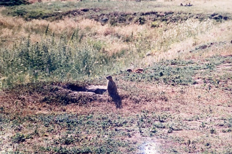
Prairie dog towns abound.

New photo by Wanderlust Family Adventure / Google Photos

Cassiar Highway – British Columbia, Canada

The Cassiar Highway is an alternate route roughly paralleling the lower portion of the Alaska Highway. When driving the Alaska Highway it is a good way to catch some different scenery on the trip back from Alaska.

New photo by Wanderlust Family Adventure / Google Photos

The highway is remote and offers ample opportunity for viewing wildlife along the way especially bears. A junction with Route 37A (The Glacier Highway) brings you to Bear Glacier which can be seen right from a lookout on the road. Bear Glacier is now a provincial park.

New photo by Wanderlust Family Adventure / Google Photos

The tiny towns of Stewart, British Columbia and Hyder, Alaska are charming vestiges of coastal Alaskan Peninsular life.

New photo by Wanderlust Family Adventure / Google Photos

Bear Glacier – British Columbia, Canada

Bear Glacier is a destination for travelers on the Cassiar Highway in British Columbia. Just a short side trip on Highway 37A towards Stewart, the Bear Glacier descends towards Strohn Lake, down Bear River Pass.
Ice once filled all of the pass, but in the 1940’s, the glacier began to retreat and Strohn Lake formed in the exposed basin. In 1967, Bear Glacier melted away from the valley wall and Strohn Lake was no longer dammed. Since then the glacier has continued its retreat.

New photo by Wanderlust Family Adventure / Google Photos

Chugach State Park – Anchorage, Alaska

Chugach State Park covers 495,204 acres in south-central Alaska. Though primarily in the Municipality of Anchorage, a small portion of the park north of the Eklutna Lake area in the vicinity of Pioneer Peak lies within the Matanuska-Susitna Borough. Established by legislation signed into law on August 6, 1970, by Alaska Governor Keith Miller, this state park was created to provide recreational opportunities, protect the scenic value of the Chugach Mountains and other geographic features, and ensure the safety of the water supply for Anchorage. The park, managed by Alaska State Parks, is the third-largest state park in the United States, and consists of geographically disparate areas each with different attractions and facilities. Eklutha Lake, Eagle River and the Turnagain Arm each offer unique recreational and sightseeing opportunities. Although a wilderness park it is within easy access to Alaska’s largest city.

New photo by Wanderlust Family Adventure / Google Photos

The Dall Sheep can be easily viewed on the cliffs from vantage points along the highway.

New photo by Wanderlust Family Adventure / Google Photos

Kluane National Park and Reserve – Yukon Territory, Canada

Kluane National Park and Reserve are two protected areas in the southwest corner of the territory of Yukon. The National Park Reserve was set aside in 1972 to become a national park, pending settlement of Native American land claims. It covered an area of 8,499 square miles. When agreement was reached with the Champagne and Aishihik First Nations over an eastern portion of the Reserve, that part—about 2,300 square miles became a national park in 1993, and is a unit of the national park system administered co-operatively with Parks Canada. The larger western section remains a Reserve, awaiting a final land claim settlement with the Kluane First Nation. The park borders British Columbia to the south, while the Reserve borders both British Columbia to the south, and the United States (Alaska) to the south and west.
The Reserve includes the highest mountain in Canada, Mount Logan at 19,551 feet of the Saint Elias Mountains. Mountains and glaciers dominate the park’s landscape, covering 83% of its area. The rest of the land in the park is forest and tundra—east of the largest mountains and glaciers—where the climate is colder and drier than in the western and southern parts of the park. Trees grow only at the park’s lowest elevations.
The bi-national Kluane-Wrangell-St. Elias-Glacier Bay-Tatshenshini-Alsek park system comprising Kluane, Wrangell-St Elias, Glacier Bay and Tatshenshini-Alsek parks, was declared a UNESCO World Heritage Site in 1979 for the spectacular glacier and icefield landscapes as well as for the importance of grizzly bears, caribou and Dall sheep habitat. This is one of the largest areas of protected land in the world and is immensely wilderness with limited access except by foot or snowshoe. You can still enjoy the expansive vistas from the road.

New photo by Wanderlust Family Adventure / Google Photos